
How Drones Are Transforming Power and Utility Operations
/
From Entergy
Across the power and utility sector, drones are embedded in daily operations—from inspecting transmission lines and monitoring vegetation to strengthening grid security and improving storm preparedness.
This shift is happening at a time when utilities face mounting pressure. Aging infrastructure, extreme weather events, workforce constraints, and reliability mandates are forcing operators to rethink how they maintain and protect critical assets. The U.S. grid alone includes more than 500,000 miles of transmission lines and roughly 5 million miles of distribution lines, all requiring constant inspection and maintenance.
Drones are emerging as one of the most practical tools to manage that scale and complexity. They enable utilities to collect better data faster, reduce risk to crews, and make more proactive decisions about infrastructure health.
Keep reading to learn the key trends shaping drone adoption in the power and utility industry, along with real-world examples showing how utilities and service providers are putting these capabilities into practice.
Where can you connect with the most utility UAV leaders, see the latest tech and hear the most recent project updates this Summer? At the Energy Drone & Robotics Summit this June in Houston!
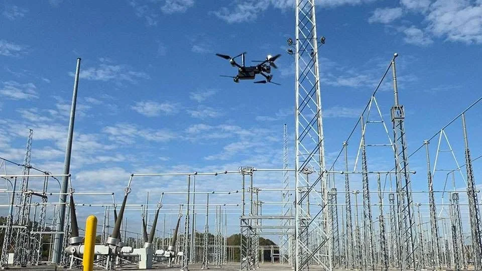
Trend 1: Drone Inspections Are Becoming the Default for Grid Maintenance
Drone-based inspections are rapidly replacing traditional methods like helicopter surveys and manual tower climbs. The primary drivers are straightforward: safety, efficiency, and cost.
Drones allow utilities to inspect energized infrastructure from a distance while capturing high-resolution imagery, thermal data, and 3D models. That means fewer climbs, fewer helicopter flights, and faster turnaround times for maintenance decisions.
Automation is also playing a major role. Pre-programmed flight paths ensure consistent coverage of assets, while analytics software flags potential defects (like cracked insulators or vegetation encroachment) before they lead to outages.
Case Study: Midwest Utility Modernizes Inspections
One major U.S. utility in the Midwest partnered with Cyberhawk to overhaul its inspection workflow after experiencing repeated outages in a specific region.
The company implemented a multi-sensor drone strategy combining:
Close visual inspections
LiDAR scanning
Thermal imaging
Corona detection
Inspection data was uploaded daily to the Cyberhawk iHawk platform, where engineers delivered actionable insights within hours.
The results:
Same-day maintenance decisions
Faster issue resolution
More than $1.1 million in annual savings
A scalable model that was eventually deployed across the utility’s broader network
This type of phased rollout—starting with a targeted problem area and expanding once results are proven—is becoming a common approach across the industry.
Trend 2: The Real Value of Drones Is in the Data
Early drone programs focused primarily on capturing images. Today, the focus has shifted to data integration and analytics. Utilities are increasingly treating drone data as a strategic asset that supports asset management, vegetation control, engineering planning, and regulatory compliance.
Large programs generate enormous volumes of information. Drone inspections can produce terabytes or even petabytes of data, making robust data management systems essential for turning raw imagery into operational insight.
This shift is transforming drone programs from inspection tools into decision-support systems.
Case Study: Geos3D Using LiDAR for High-Voltage Line Analysis
For utilities managing complex terrain or dense vegetation, high-resolution spatial data is becoming essential for long-term planning.
Engineering firm Geos3D conducted a high-voltage power line inspection using a drone equipped with a LiDAR sensor. The system produced detailed point-cloud data that allowed engineers to:
Measure conductor clearance from the ground
Identify vegetation hazards
Model infrastructure in 3D
Verify safe distances for roads and heavy equipment
The entire survey covered the inspection area in just over 12 minutes of flight time, demonstrating how LiDAR can dramatically reduce fieldwork while improving data quality.
Trend 3: Predictive Maintenance and Repeatable Inspections
One of the most important developments in utility drone programs is the shift from periodic inspections to continuous condition monitoring.
Historically, inspections captured snapshots of asset condition at a single point in time. Today, drones enable repeatable measurements from the exact same location across multiple inspection cycles, which changes the output from isolated data points into time-spanning intelligence.
This capability is critical for predictive maintenance programs, which rely on consistent data to calculate corrosion rates, structural degradation, and remaining asset life.
Case Study: AR-Guided Repeatable Drone Inspections
Inspection technology provider Voliro introduced an augmented reality (AR) guidance system that allows operators to return to the exact same inspection location on an asset during future missions.
The system records the precise coordinates of each measurement point and overlays visual markers during subsequent inspections. A pilot stays in control, but AR guidance allows imaging that compares apples to apples, which gives big benefits to inspection programs:
Compounding data value over time
Accurate time-series data collection
More confidence in AI data analysis
Trend 4: Drones as Tools for Storm Preparedness and Grid Resilience
Extreme weather is reshaping how utilities manage risk. Instead of focusing solely on restoration after storms, utilities are investing in predictive resilience. One way to do that is by identifying vulnerabilities before damage occurs.
Drones are central to this shift because they provide continuous visibility into infrastructure health. High-resolution aerial imagery allows utilities to detect early warning signs like:
Encroaching vegetation
Weak or aging poles
Dead or diseased trees
Structural stress in transmission assets
Vegetation management supported by aerial data can reduce outage-prone trouble spots by more than 45 percent. With regular drone monitoring, inspection cycles that once occurred every few years can now happen more frequently to help utilities keep infrastructure more resistant to disaster.
Trend 5: Counter-Drone Security (C-UAS) Is Becoming a New Priority
As drones—both commercial and personal—become more common, utilities are confronting a new operational risk: unauthorized drone activity near critical infrastructure.
Industry leaders increasingly view airspace security as an extension of traditional physical security. Recent research from the North American Electric Reliability Corporation (NERC). highlighted growing concern about drone-based threats to substations, generation facilities, and transmission assets.
As part of NERC’s latest electric grid security exercise, GridEx VIII, hundreds of organizations tested their emergency preparedness plans and protocols. The exercise revealed several key gaps:
Limited authority to intervene against drones in flight
Inconsistent regulatory guidance
Need for better detection technologies
Utilities are now exploring solutions like:
Low-altitude radar systems
Airspace monitoring platforms
Integrated command-and-control systems
These tools provide real-time awareness of drone activity around critical infrastructure and support coordinated response planning. C-UAS capabilities are likely to become a standard component of utility security programs over the next decade.
Drones Are Part of the Team
Across the power/utilities industry, drone programs are helping companies:
Reduce risk to workers
Improve inspection speed and accuracy
Enable predictive maintenance
Strengthen storm preparedness
Enhance grid security
Make faster, data-driven decisions
In other words, drones are helping utilities become proactive infrastructure managers. As automation, analytics, and security capabilities continue to evolve, their role in utility operations will only expand.