
Flight of the Utilities: How Ameren Turned Drone Data into a Survival Strategy
/Mother Nature has officially entered her "scorched earth" era, and she’s no longer just targeting the usual suspects in California. From Missouri tornadoes to Midwest ice storms, the grid is under siege by a risk landscape that’s lost its mind.
From EE ONline
As James Pierce, the leader of Ameren’s drone and inspection programs has made clear, the conditions we face today won’t be the same ones we face in a decade. In the utility world, "resilience" is no longer a buzzword you throw into an ESG report to keep investors happy; it is the difference between a quick post-storm recovery and a catastrophic loss of quality of life for millions.
This week at the Nexus, we’re breaking down the Ameren blueprint—a journey from a two-man pilot project in 2015 to a centralized, AI-powered intelligence operation that treats remotely sensed data like a high-stakes military maneuver.
1. The Death of the "Regional Risk" Myth
For years, utilities in the Midwest slept soundly, thinking wildfires were a "West Coast problem" and derechos were once-in-a-generation flukes. That era is over. Wildfire risk is creeping eastward into the dense wilderness of Missouri and Illinois, and Missouri saw more tornadoes in the first half of 2025 than are normally expected in an entire year.
The mandate is clear: Resilience cannot be reactive. If you wait for the storm to hit before you modernize your inspection cycle, you’ve already lost. Ameren’s approach signals a shift toward "blue-sky" inspections—using clear days to spot early signs of wear and establish asset baselines so that when the "black-sky" days arrive, the grid is already hardened.
2. Governance with Teeth: The Centralized Powerhouse
One of the most critical lessons from the Ameren front is the move away from "grassroots" innovation. In the early days, drone programs were often run by a few enthusiasts in a truck with a lot of questions and very few answers. Ameren killed that model by creating a centralized service structure.
This isn't just about corporate hierarchy; it’s about Standardized Risk Mitigation. By centralizing, Ameren provides a single source for:
Airspace Compliance: Keeping the FAA in the loop.
Cybersecurity: Ensuring your drones aren't a back-door for state-sponsored actors.
Data Standards: Making sure the imagery captured in one territory matches the requirements of another.
If your drone program is still run by disparate departments with no central oversight, you aren't innovating—you’re just flying expensive toys and creating liability.
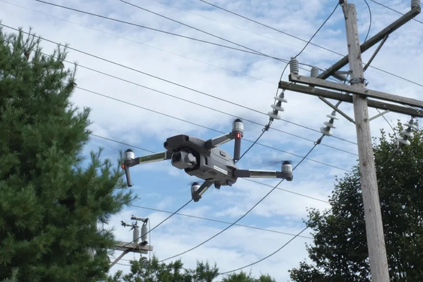
3. Beyond "Boots on the Ground": Field Ops Reimagined
Historically, damage assessment was a slow, grueling process involving manual structure climbs or hiring expensive manned helicopters. Ameren’s shift to drones changed the math. During major storm events, teams deployed to key circuits in difficult terrain can now provide a comprehensive visual assessment within minutes of arriving on site.
Compare this to the "old way," which took hours or days of literal boots-on-the-ground hiking through mud and debris. By feeding this visual intelligence into Ameren’s GIS mapping systems, storm management teams can dispatch repair crews directly to the most critical points. It turns "emergency response" into "surgical precision."
4. The "Co-Pilot" Box: Real-Time AI Triage
Capturing images is the easy part. A single post-storm survey can generate tens of thousands of photos. If your "advanced" drone program requires a human to sit in a dark room for three weeks clicking through JPEGs to find a cracked insulator, you’ve failed.
Ameren’s "co-pilot" compute box is the future of utility operations, but it doesn't work in a vacuum. By partnering with Buzz Solutions, Ameren leverages specialized AI models designed to translate raw inspection imagery into clear, prioritized maintenance actions in minutes. While the pilot is still in the air, the AI handles the first pass—detecting defects and flagging anomalies with GPS coordinates and pole tags.
Furthermore, Ameren collaborates with EPRI (Electric Power Research Institute) to explore photogrammetric solutions and automated reporting. This partnership ensures the AI isn't just identifying a "problem," but is evaluating it against industry-standard failure modes. The goal is to ensure skilled inspectors and lineworkers focus their time only on high-priority work, rather than wading through mountains of irrelevant data.
5. GIS: The Force Multiplier
As a career GIS professional, Ameren's program lead has integrated geospatial principles into every layer of the operation. Every image captured and every anomaly flagged is geospatially anchored. This turns "visual intelligence" into "operational intelligence."
Esri is the central nervous system of this operation. By using Esri Field Maps and Survey 123, Ameren provides real-time information to drone pilots while simultaneously collecting the precise data needed to fulfill strict regulatory requirements.
When a drone flags a localized corrosion point, Ameren doesn't just see a picture of rust; they see exactly where that asset sits within the larger grid, how its condition has changed over the last five years, and which customers will be affected if it fails. Using tools like Esri Field Maps and Survey 123, they provide real-time data to operators while simultaneously fulfilling strict regulatory requirements.
6. The Corporate Gauntlet: Cybersecurity and Air-Gapping
In an era of increased scrutiny on critical infrastructure, Ameren’s data governance is a lesson in paranoia—and rightly so. Drones never connect to the corporate network. Media comes in via SD cards, passes through malicious file scans, and lives on high-capacity on-prem servers.
While the cloud is useful, Ameren limits its use to comply with federal requirements. This "air-gapped" mentality might seem old-school to Silicon Valley types, but for a utility responsible for millions of lives, it is a non-negotiable layer of defense against cybersecurity vulnerabilities that bridge the digital and physical domains.
7. Hard Truths: Why Your Program Might Fail
Implementation isn't all cool gadgets and high-res thermal scans. Ameren identified several "real-world" hurdles that can sink a program:
The Sponsorship Gap: Grassroots efforts will not sustain a corporate program. You need top-down executive sponsorship from day one.
The Awareness Roadshow: Even years after launch, parts of your own company won't know you exist. You have to be your own PR agent, constantly running roadshows to build internal demand.
Supply Chain Volatility: Between tariffs, regulatory and policy shifts, and shortages, you can't rely on a single hardware source. Diversify your sourcing early or prepare to be grounded.
8. The Horizon: BVLOS and Predictive Resilience
The future of the grid is predictive. Ameren is already aligning its training and data governance with the FAA’s newly proposed Beyond Visual Line of Sight (BVLOS) rules. By obtaining nationwide BVLOS waivers, they are preparing for a world where drones can autonomously patrol thousands of miles of line without a pilot needing to keep eyes on the aircraft.
Resilience isn’t a project with an end date; it’s a daily practice. The combination of sensors, GIS, AI, and sheer human ingenuity isn't just about reviewing images faster—it’s about embedding a data-driven defense into every layer of utility operations.
The Nexus Takeaway: If you aren't building a "centralized intelligence" model for your asset inspections, you are essentially waiting for the next derecho to tell you where your weaknesses are. Don't be that utility. Stop dabbling and start scaling.
(h/t EE Online’s Article How Utilities Can Build Resilience Against Unplanned Events with AI and Aerial Technology by James Pierce of Ameren)